Driving Here
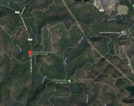
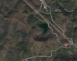
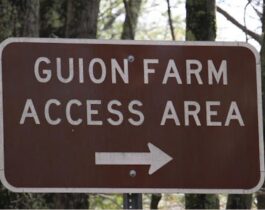
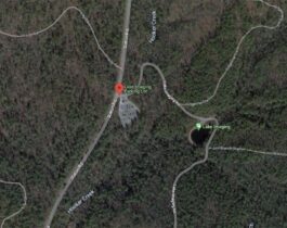
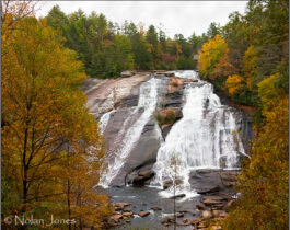
Most driving directions lead to the High Falls Access Area located at:
Driving directions to the other access areas are at the bottom of this page.
Try out the digital map from Friends of DuPont Forest that allows you to track your hikes and rides inside the Forest without using a cell phone signal (updated October 2020).
The map uses the free Avenza app and costs only $4.99. Best of all, proceeds go back into projects to support the Forest.
Step 1)
Download the Avenza Map App from Google Play or the App Store
Step 2)
Purchase the DuPont Map from the Avenza Store
$15 donation
Find out more about this map & the partnership with National Geographic
Friends of DuPont Forest has partnered with National Geographic to create a Trails Illustrated Topographic Map of DuPont State Recreational Forest. This map includes suggested routes highlighted with descriptions and elevation profiles. Routes were designed by FODF members and can be used by all users of the forest. Because of this partnership, FODF is an Authorized Distributor of the map and can therefore be purchased online from Paypal link below. FODF can also distribute to retailers at wholesale. Profits from map sales are used to support conservation, education, and recreational activities in DuPont State Recreational Forest.
From Asheville, NC and other cities via I 40
Take I 40 to exit 46A for I 26 East towards Hendersonville. Take I 26 east to Exit 40. Turn right off Exit 40 onto NC 280. Take NC 280 south 16 miles to US 64. Turn left onto US 64 and go 3.7 miles to the stop light. Turn right onto Crab Creek Rd and go 4.3 miles to DuPont Road. Turn right onto DuPont Rd and go 4.2 miles. Note that DuPont Rd becomes Staton Road.
From Greenville, SC and Brevard, NC via US 276 to Cedar Mountain
Take US 276 to the intersection with Cascade Lake Road in Cedar Mountain, NC. This intersection is 1.6 miles north of the NC/SC state line and is 11 miles south of downtown Brevard. The Cedar Mountain Fire Dept. is at this intersection. Turn onto Cascade Lake Rd and go 2.5 miles. Turn right onto Staton Road and go 3.2 miles.
From Hendersonville, NC and other cities via I 26
Take I 26 to exit 49B for US 64 west towards Hendersonville. Go 2.4 miles on US 64 to North Church Street/Business US 25 south. Turn left onto Church Street and go 0.6 south miles. Turn right onto Kanuga Road and go 11 miles (note that Kanuga Rd becomes Crab Creek Rd). Turn left onto DuPont Road and go 4.2 miles. Note that DuPont Rd becomes Staton Road.
From locations west of Greenville, SC via I 85
Take I 85 from Georgia across the SC state line to Exit 1 for SC 11 towards Westminister. Go north on SC 11 58 miles to the intersection with US 276. Turn left onto US 276 and go north 12 miles to the Cedar Mountain Fire Dept. at the intersection with Cascade Lake Road. This intersection is 1.6 miles north of the NC state line. Turn right onto Cascade Lake Rd and go 2.5 miles to Staton Road. Turn right onto Staton Road and go 3.2 miles.
From locations east of Greenville, SC via I 85
Take I 85 to Exit 70 for I 26 towards Asheville. Go north on I 26 to Exit 5 for SC 11. Turn left from the ramp onto SC 11 and go 26 miles to the intersection with US 276. Turn right onto US 276 and go north 12 miles to the intersection with Cascade Lake Road in Cedar Mountain, NC. This intersection is 1.6 miles north of the NC state line. Turn right onto Cascade Lake Rd and go 2.5 miles. Turn right onto Staton Road and go 3.2 miles.
Directions to High Falls Access Area
From Crab Creek Road (Brevard/Hendersonville)
Turn south 4. 0 miles on DuPont Road that turns into Staton Road. Go past the Hooker Falls Access to High Falls Access Area of the left.
From Cedar Mountain (US-276)
Turn south 4. 0 miles on DuPont Road that turns into Staton Road. Go past the Hooker Falls Access to High Falls Access Area of the left. Turn north 2.5 miles on Cascade Lake Road and a right on Staton Road at the DuPont State Recreational Forest sign. Follow Staton Road 1.3 miles to the High Falls Access Area on the right.
Directions to Hooker Falls Access Area
From Crab Creek Road (Brevard/Hendersonville)
Turn south 3.1 miles on DuPont Road that turns into Staton Road to the Hooker Falls Access Area on the right, just before the DOT bridge across the Little River.
From Cedar Mountain (US-276)
Turn north 2.5 miles on Cascade Lake Road past the Corn Mill Shoals Access Area. Turn right on Staton Road at the DuPont State Recreational Forest sign 2.2 miles past the High Falls Access Area to the Hooker Falls Access Area on the left, just past the DOT bridge across the Little River.
Directions to Corn Mill Shoals Access Area
From Crab Creek Road (Brevard/Hendersonville)
Turn south 5.3 miles on DuPont Road that turns into Staton Road. Go past the Hooker Falls and High Falls Access Areas to a left at the end of Staton Road on Cascade Lakes Road. The Corn Mills Shoals Access Area is 0.8 miles on the right.
From Cedar Mountain (US-276)
Turn north on Cascade Lake Road 1.7 miles to the Corn Mill Shoals Access Area on the left.
Directions to Fawn Lake Access Area
From Crab Creek Road (Brevard/Hendersonville)
Turn south 5.3 miles on DuPont Road that turns into Staton Road. Go past the Hooker Falls and High Falls Access Areas to a left at the end of Staton Road on Cascade Lakes Road. Go 2.5 miles past the Corn Mills Shoals Access Area to a left on Reasonover Road just before US-276. The Fawn Lake Access Area is 2.8 miles on the left.
From Cedar Mountain (US-276)
Turn north on Cascade Lake Road to an immediate right for 2.8 miles on Reasonover Road. The Fawn Lake Access Area is on the left.
Directions to Guion Farm Access Area
From Crab Creek Road (Brevard/Hendersonville)
Turn south 0.7 miles on DuPont Road to a left on Sky Valley Road. Follow Sky Valley Road past the junction of Old CCC Road to the Guion Farm Access Area 1.6 miles on the right.
From Cedar Mountain (US-276)
Turn north 2.5 miles on Cascade Lake Road past the Corn Mill Shoals Access Area. Turn right at the DuPont State Recreational Forest sign 4.6 miles on Staton Road past the Buck Forest, Hooker Falls and Lake Imaging Access Areas. Turn right 1.6 miles on Sky Valley Road past the junction of Old CCC Road to the Guion Farm Access Area on the right.
Directions to Lake Imaging Access Area
From Crab Creek Road (Brevard/Hendersonville)
Turn south 2.6 miles on DuPont Road that turns into Staton Road to the Lake Imaging Access Area on the left.
From Cedar Mountain (US-276)
Turn north 2.5 miles on Cascade Lake Road past the Corn Mill Shoals Access Area. Turn right on Staton Road at the DuPont State Recreational Forest sign 2.7 miles past the High Falls and Hooker Falls Access Areas, to the Lake Imaging Access Area on the right.
Henderson County Travel and Tourism (Visitor’s Information Center) and Transylvania County Tourism have brochures and information about the forest available in their offices.
Many thanks as well to our local business sponsors, be sure to stop by and say hello to them!